Nea Paphos Theatre: 2015 Season |
First Published: C. Barker, AAIA Bulletin, Vol. 12, 2016. pp. 14-17
|
|
Between the 11th and 19th of September 2015, the Australian Archaeological Mission to the site of the ancient theatre of Nea Paphos (fig. 1) from the University of Sydney, working under the auspices of the Department of Antiquities of Cyprus, conducted a geo-mapping survey of the ruins of the town’s Roman colonnades. The project, celebrating its 20th anniversary, is supported by the AAIA and the Nicholson Museum.
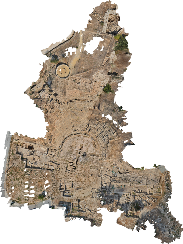
In the time the Australian team has been excavating at the site we have uncovered the oldest theatre in Cyprus, carved into the southern slope of a hill known as Fabrika. The theatre was used as a venue for performance and spectacle for over six and a half centuries from c. 300 BC until its final destruction in the earthquakes of AD 365, undergoing several architectural modifications throughout the Hellenistic and Roman eras. More recent excavations have attempted to position the theatre within its ancient urban context, by understanding the surrounding landscape and ancient structures including a nymphaeum (water fountain). Excavations to the south of the theatre by the Australian Mission have revealed a Roman paved road, approximately 8.4 m wide, which acted as the main traffic thoroughfare to access to the theatre (which would have seated over 8500 spectators in the 2nd century AD) and the nymphaeum. We speculate that this road represented a, if not the, major internal thoroughfare for the Roman city of Nea Paphos leading to the nearby North-East city gate. It would have acted also as the processional route to the Sanctuary of Aphrodite at Palaepaphos from the city. The existence of this road confirms the long-speculated city design for Nea Paphos: that of a typically ‘Milesian’ Hellenistic city (i.e. a grid with several distinctive parts of the town laid out to take advantage of the topography of the ancient city). The importance of the road in antiquity is further suggested by the discovery of numerous fragments of granite columns on the site (over thirty fragments to date), which we suggest were used in the construction of colonnades along the main Roman roads of the city. The granite columns had previously been proven by Olwen Williams-Thorpe, in a scientific examination of the stone, to have been imported to Paphos from granite quarries in Troad in Turkey (fig. 2); part of a massive Roman trade across the eastern Mediterranean in architectural elements Troad granite columns are known from colonnades in locations as diverse as Jerusalem, Leptis Magna and Rome itself. As both the capital city of Cyprus and a major trading emporium with the East, it is not surprising that Nea Paphos was adorned with this symbol Roman civic order. The survey of the visually identifiable granite column fragments of Nea Paphos located some 167 individual column fragments; all in secondary or subsequent usage. Many were reused for example in the construction of the Crusader-period fort called Saranda Kolones (indeed they have given the building its modern name—forty columns), and others in the Early Christian basilica at Chrysopolitissa. Others still are incorporated into 19th and 20th century walls or street furniture, or are used in modern parks and gardens. Each column fragment was recorded in detail: its precise position was recorded using Total Station and survey grade GPS and then plotted out on maps of Paphos (both modern maps and proposed plans of the layout of the ancient city) (fig. 3). With the locations mapped it is possible to demonstrate that the majority of the column fragments visible at surface level are from two distinct axes through the ancient town, or that those columns that have been moved from these two main zones have been done so for a precise and provable purpose, such as the construction of Saranda Kolones. As a result of this mapping, it can now be suggested that the modern road called Odos Ayias Kyriakis, which runs north-south from the harbour to the theatre, traces the route of the ancient colonnaded main south-north orientated road (the cardo maximus) of Roman Nea Paphos. The ancient road running on the east-west orientation excavated by the Australian team just south of the ancient theatre (the decumanus maximus) was likewise colonnaded and running from the ancient north-east city gate all the way to the acropolis on Farani, the eastern hill of the ancient city, near the ancient agora. Both of these roads were part of the urban structure, and both represented the two major thoroughfares of the ancient city, although other sizable roads must have existed. Scattered granite column fragments across the Paphos archaeological park are the remains of the decumanus colonnade in this area; the excavations at the theatre have revealed colonnade fragments from the eastern section of the thoroughfare. It is hoped that future excavation of the road south of the theatre may reveal more of the granite columns, hopefully in situ so as to give an indication as to the spacing of the colonnade. Analysis of the Troad granite columns recorded is currently underway. The largest but least common type of columns are those found reused in the central nave of the basilica of Chrysopolitissa that measure 24 Roman feet (over 7 m). However, these large columns are exceptional. The majority of the other columns are of 12 Roman feet, 14 Roman feet and predominantly 16 Roman feet (approximately 4.6 m). This is indicative of a trend in size differentiation across the city. The precise positioning of each column group within the ancient town is not yet known as no in situ column has been located thus far. Nor do we yet know the date of the construction of the colonnades, although it seems likely to have occurred during the 2nd century AD, a period of profound wealth for the citizens of Nea Paphos and of Imperial architectural dominance across the eastern Mediterranean. In addition to the colonnade survey, the ancient theatre site was recorded for the first time using pole photography (fig. 4) and photogrammetric programs (Agisoft PhotoScan) to stitch together over two thousand individual images. The resulting orthographically-correct 3D image of the ancient theatre and surrounding areas of Fabrika hill (fig. 5) will provide a valuable visual perspective of the site and will assist with future planning of location of trenches and in the understanding of the urban layout of the Roman period of the town in the area around the ancient theatre. With the high resolution of the image, measurements can be taken from any position within the photograph with an accuracy of +/- 10 mm. Considerable planning for future seasons was also undertaken in this year without excavation, including the development of new finds storage and processing strategies to be implemented in the planned 2016 excavation season. |
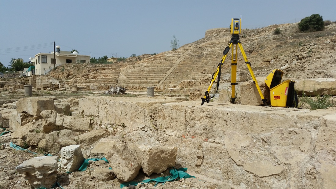
Fig. 1, Surveying equipment against the backdrop of the theatre.
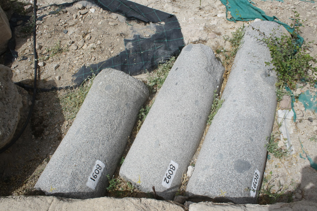
Fig. 2, Troad granite column fragments originally from a Roman colonnade but abandoned on the eastern parodos of the theatre of Nea Paphos in late antiquity.
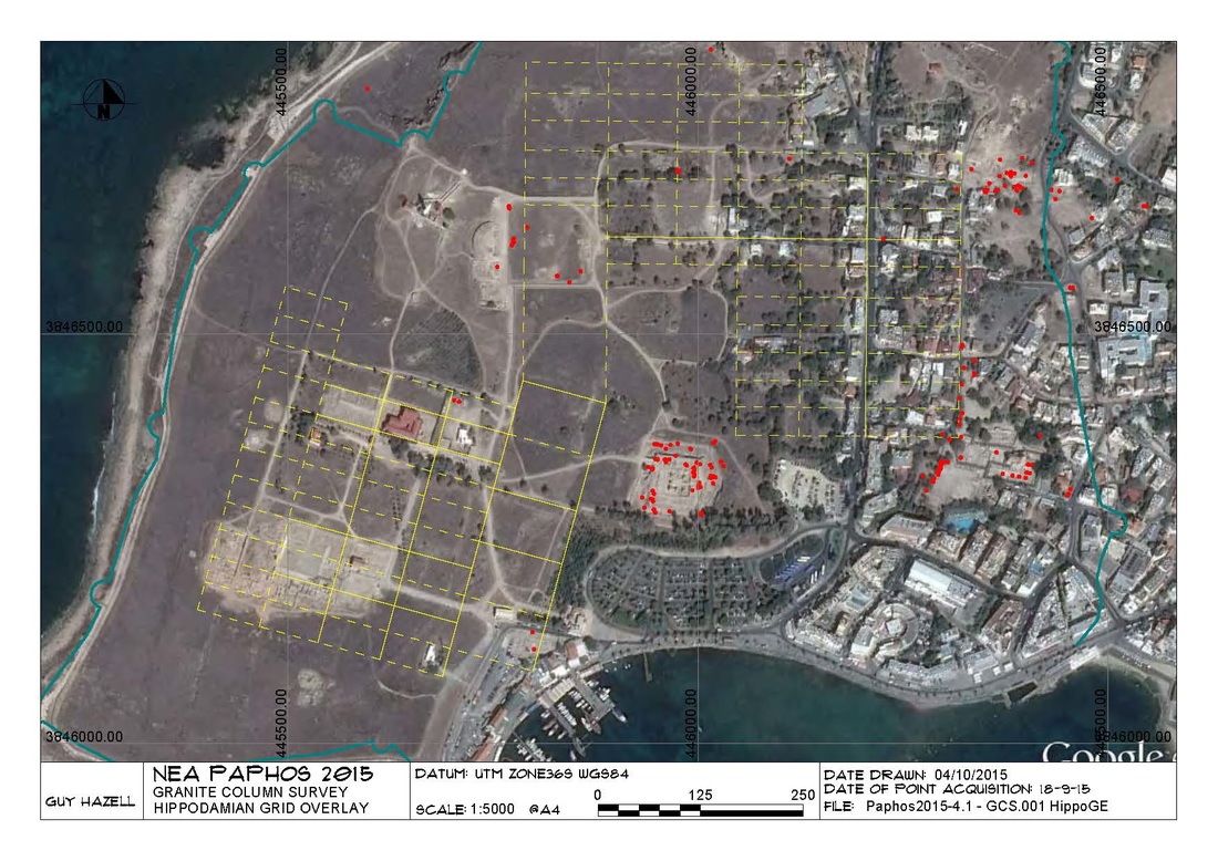
Fig. 3, Map showing precise locations of visible granite columns from the colonnade – predominantly around the
road leading from the harbour which may shadow the ancient Roman cardo maximus and near the theatre which may represent the ancient Roman decumanus
maximus, with large reuse of the columns at Chrysopolitissa and Saranda Kolones.
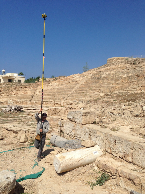
Fig. 4, Surveyor Guy Hazell conducting a pole photograph survey on the site of the ancient theatre.
Fig. 5, (below) The photogrammetric image of the ancient theatre and Fabrika taken during the pole photography project.
|